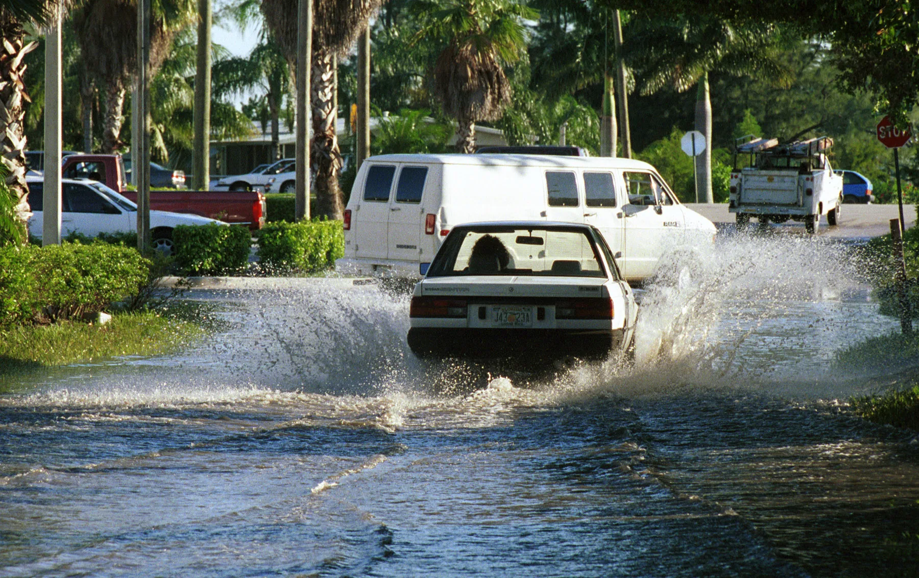
A flood watch covers Fort Lauderdale through 3 p.m. Monday, with 3 to 5 inches of rain possible and moderate tidal flooding near the 2:31 p.m. high tide.
Fort Lauderdale is under a flood watch until 3 p.m. Monday. Rounds of heavy rain could drop 3 to 5 inches in places along the coast, and isolated spots could see 5 to 7 inches.
The National Weather Service in Miami issued the flood watch at 12:49 p.m. Sunday. It covers coastal, metro and inland Broward County, along with most of Miami-Dade and Palm Beach counties. The weather service said much of that rain “may fall over a window of a few hours.”
It comes on top of a week of tidal flooding. A coastal flood advisory for moderate flooding in coastal Broward County now runs until 7 p.m. Monday.
What the weather service expects
The watch lists these impacts:
- isolated to scattered flash flooding
- street flooding and road closures
- limited impact to buildings in flood-prone areas
The weather service warned that impacts “could be greater than forecast if the heaviest rainfall occurs near the coast during times of high tide.” Its forecast discussion on Sunday afternoon said parts of the east coast metro areas had already had 1 to 3 inches. It expects another 1 to 3 inches tonight into Monday, with 3 to 5 inches where the stronger storms set up.
The Fort Lauderdale forecast breaks it down:
| Period | Chance of rain | New rain possible |
|---|---|---|
| Sunday night | 80% | 2 to 3 inches |
| Monday | 80% | 1 to 2 inches |
| Monday night | 70% | a half to three-quarters of an inch |
| Tuesday, Election Day | 70% | not yet forecast |
East winds of about 15 mph are expected, with gusts to 24 mph.
The tide makes it worse
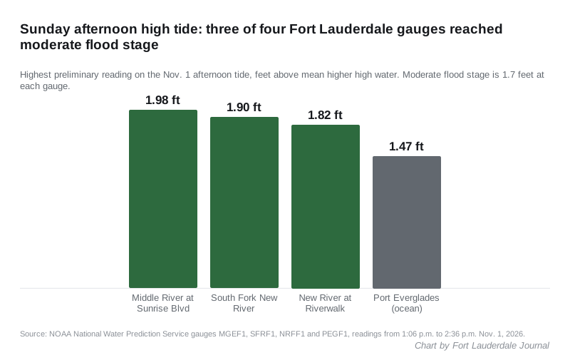
The rain falls on water that is already high. On Sunday afternoon’s high tide, three of the four Fort Lauderdale tide gauges passed the 1.7-foot moderate flood level. The readings come from the Middle River, South Fork New River, New River and Port Everglades gauges. Heights are preliminary, in feet above mean higher high water:
- Middle River at Sunrise Boulevard: 1.98 feet at 2:12 p.m.
- South Fork New River near Secret Woods Nature Center: 1.90 feet at 2:36 p.m.
- New River at the Riverwalk: 1.82 feet at 1:24 p.m.
- Atlantic Ocean at South Port Everglades: 1.47 feet at 1:06 p.m.
Those are well below the 2.83 feet the Middle River gauge reached during last week’s king tides. The weather service said the water may dip “briefly (and barely)” below moderate levels Monday. It kept the advisory in place because the chance of moderate flooding was still too high.
Monday’s high tides at Port Everglades are predicted for 1:50 a.m. and 2:31 p.m., according to NOAA’s tide predictions. Daylight saving time ended Sunday, so those times are Eastern Standard Time. Tuesday’s high tides are at 3:04 a.m. and 3:34 p.m.
Beaches
A high surf advisory for 5- to 7-foot breakers runs until 7 a.m. Monday. The high rip current risk lasts through Tuesday evening, according to the weather service alert. The weather service told inexperienced swimmers to stay out of the water and everyone else to swim near a lifeguard. Its forecast discussion expects dangerous beach conditions “through mid-week.”
What comes next
The next run of king tides is Nov. 5-11, according to the city’s high tides page. The weather service said water levels will start climbing again by midweek toward the new moon on Nov. 9. It expects drier weather later in the week, when a front shifts the winds and ends the steady showers.
What it means for you
- Do not drive through standing water. Turn around at barricades and do not enter water of unknown depth, the weather service said.
- Plan around 2:31 p.m. Monday. That is the afternoon high tide. Heavy rain near then is the worst case for streets near the rivers and canals.
- Be ready if you live in a flood-prone area. The weather service told residents there to be prepared to act if flooding develops and to watch for flood warnings.
- Stay out of the ocean through Tuesday. The rip current risk is high.
- Voting Tuesday? Polls are open 7 a.m. to 7 p.m., and storms are likely. Our ballot guide has what is on it.
- Report a flooded or blocked street to the city’s Customer Support Center at 954-828-8000 or through FixIt FTL.
Planned closures are on our road construction and closures page. The hurricane prep guide covers flood zones and flood insurance, and the trash and recycling page has this week’s pickup schedule.
Have your say